|
|
 |
Area covering Keswick, Cockermouth & Wigton. The 'Active' maps are 'encapsulated' weather proof maps. We also offer the OS classic paper map
The North-Western area map is one of four OS Explorer maps covering the EnglishL
|
|
|
|
 |
Ordance Survey, OL 5 Lakes NE 1:25,000 map
Area covering Penrith, Patterdale & Caldbeck. The 'Active' maps are 'encapsulated' weather proof maps. We also offer the OS classic paper map
Whether you wish to...
|
|
|
|
 |
Ordance Survey OL6 Lakes South Western 1:25,000 map
Area covering Coniston, Ulverston & Barrow in Furness. The 'Active' maps are 'encapsulated' weather proof maps. We also offer the OS classic paper map
Explore...
|
|
|
|
 |
Ordance Survey OL7 Lakes South Eastern 1:25,000 map
Area covering Kendal, Windermere & Silverdale. The 'Active' maps are 'encapsulated' weather proof maps. We also offer the OS classic paper map
All Weather...
|
|
|
|
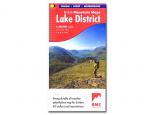 |
British Mountain Map, Lake District 1:40,000 map
Using Harvey's mapping the BMC has produced a first class map of the Lake District
All the areas most famous fells are all on the single sheet
Printed on a...
|
|
|
|
 |
Scafell Pike and Great Gable Hillwalker's Map & Guide
A grerat tool to help plan your trip as well as a map to have while out on the fells
A detailed 1:25,000 map and guide for Scafell Pike and Great Gable
Includes clearr
|
|
|
|
 |
Helvellyn and Fairfield Hillwalker's Map & Guide
A great aid to help plan a trip aswell as a handy map to have with you out on the fells
A detailed and popular 1:25,000 map and guide to Helvellyn and...
|
|
|
|
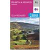 |
Map of Penrith & Keswick, Ambleside 90
Landranger map 1:50 000 scale
Map sheet number 90 in the OS Landranger map series is the perfect map for planning holidays and day trips to the Penrith and Keswick area of the Lake District.
Thea
|
|
|
|