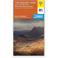
Ordance Survey OL7 Lakes South Eastern 1:25,000 map
Area covering Kendal, Windermere & Silverdale. The 'Active' maps are 'encapsulated' weather proof maps. We also offer the OS classic paper map
- All Weather Active Map.
- This double sided map stretching from Carnforth to the Great Rigg, and includes Lake Windermere, Killington Reservoir and Little Langdale Tarn
- Specially designed for walkers, off-road cyclists, horse riders and all involved in outdoor activities
- The South-eastern area map is one of four OS Explorer maps covering the English Lakes
- The OS Explorer Active range of OL maps now includes a digital version of the paper map, accessed through the OS smartphone app, OS Maps
|


