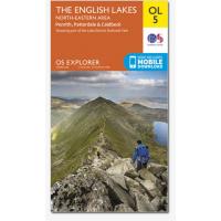
Ordance Survey, OL 5 Lakes NE 1:25,000 map
Area covering Penrith, Patterdale & Caldbeck. The 'Active' maps are 'encapsulated' weather proof maps. We also offer the OS classic paper map
- Whether you wish to follow the River Eden, explore the Haweswater Nautre Reserve or walk to the heights of Helvellyn
- Double-sided map of the North-Eastern area of the English Lakes
- Specially designed for walkers, off-road cyclists, horse riders and all involved in outdoor activities
- The North-eastern area map is one of four OS Explorer maps covering the English Lakes
- The OS Explorer Active range of OL maps now includes a digital version of the paper map, accessed through the OS smartphone app, OS Maps
|


