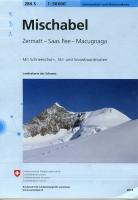
Swiss Topo 1:50,000 Mischabel 284 S
Ski Edition of the map. Fantastic looking maps with a superb use of graphic relief and hill shading, the maps give an almost 3-D picture of Switzerland's mountainous terrain
- Includes Public Transport (Bus and Rail) with stops
- Time Schedules and route numbers of the swiss Alpine Club Guide
- Slopes of more than 30 degrees in red
- List of Huts, important telephone numbers
- Information on avalanches and first aid
- For Skiers, snowboarders and snow shoeing
- Sanctuaries for wildlife and forest
- It has contours at 20m intervals, and a 1-km grid with the Swiss national coordinates
- These ski sheets cover 35 x 24 km (21 x 15 miles approx)
|


